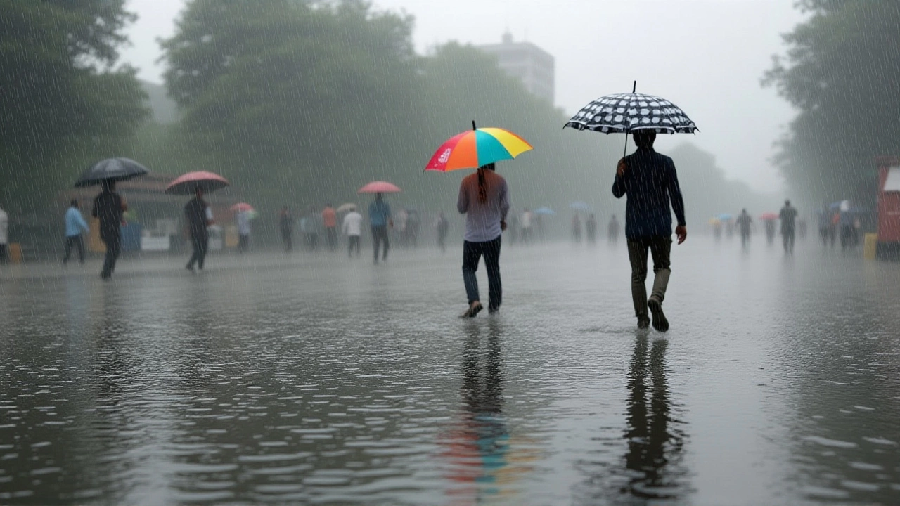
On October 29, 2025, the India Meteorological Department issued a critical weather alert for East Uttar Pradesh, warning of violent thunderstorms, lightning, and gusty winds reaching 30–40 km/h on October 30 and 31. The forecast, issued at 1400 hours IST from its Lucknow regional office, signals a sharp shift in weather patterns just as the region prepares for Diwali festivities — a time when millions travel across rural highways and urban roads. What makes this alert urgent isn’t just the rain — it’s the combination of sudden downpours, reduced visibility, and high winds that could turn already congested roads into hazardous corridors.
Why This Forecast Matters for Daily Commuters
For millions in Uttar Pradesh, especially in districts like Varanasi, Prayagraj, and Gorakhpur, this isn’t just a weather update — it’s a safety warning. The IMD’s official release (No. 4428) specifically flagged isolated heavy rainfall over these areas, with wind speeds occasionally spiking to 50 km/h in eastern zones. That’s enough to knock down weak tree limbs, dislodge poorly secured billboards, and send debris flying across busy intersections. Add to that the fact that many rural roads lack proper drainage, and you’ve got a recipe for flash flooding — the kind that stalls buses, floods underpasses, and leaves stranded travelers in the dark.
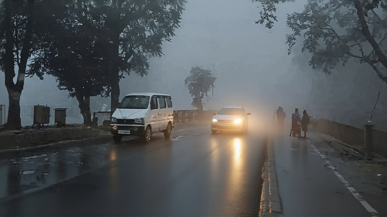
Temperature trends are also shifting dramatically. AccuWeather recorded highs of 96°F (35.6°C) in Lucknow on October 29, but by October 31, that dropped to 92°F (33.3°C). The drop isn’t just noticeable — it’s rapid. And when cool air meets moist, unstable conditions, thunderstorms ignite. The sudden chill also means fog may form overnight, especially near the Ganges floodplains, compounding the danger for early morning commuters.
Broader Pattern: A System Spanning Five States
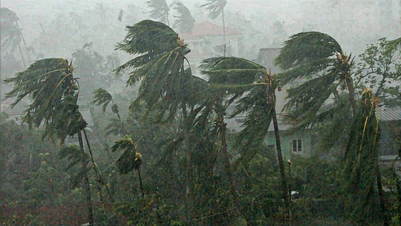
This isn’t an isolated event. The same weather system is hammering Bihar, Jharkhand, and East Madhya Pradesh. IMD predicts very heavy rainfall in parts of Bihar on October 30–31 — up to 150 mm in 24 hours in some pockets. That’s more than what Lucknow typically sees in an entire October week. Meanwhile, Vidarbha in Maharashtra is bracing for similar conditions on October 29–30, with wind gusts hitting 40–50 km/h. The pattern is clear: a low-pressure system over the Bay of Bengal is feeding moisture inland, colliding with cooler air from the northwest. It’s the same setup that caused deadly floods in 2022 — and officials are nervous.
Even the coast isn’t safe. The IMD noted squally winds of 45–55 km/h, gusting to 65 km/h, over the northeast Arabian Sea — affecting shipping lanes off Maharashtra and Gujarat. While that’s far from Uttar Pradesh, it underscores how deeply interconnected India’s weather systems have become. Climate scientists say this kind of intensified, localized extreme weather is becoming more frequent — not just due to seasonal shifts, but because of urban heat islands and changing land use patterns across the Gangetic plain.
What Authorities Are Saying
State disaster management teams in Uttar Pradesh have been activated. District collectors in Ballia, Mau, and Jaunpur have been instructed to keep emergency response units on standby. “We’ve already cleared drainage channels in flood-prone areas of Prayagraj,” said a senior official who spoke on condition of anonymity. “But if the rain comes in bursts — like the IMD warns — we’ll need more than just drainage. We need public awareness.”
Transport departments have issued advisories to bus operators: reduce speed in thunderstorm zones, avoid low-lying routes, and delay departures if visibility drops below 100 meters. School authorities in Gorakhpur and Azamgarh are considering suspending afternoon classes on October 31. “We lost a child in 2021 to lightning during a school trip,” said a headmaster from a rural school near the Nepal border. “We won’t wait for another tragedy.”
What to Expect in the Next 72 Hours
Here’s the timeline, based on IMD’s latest data:
- October 29: Mostly sunny in Lucknow (30°C), but thunderstorms begin forming in eastern districts by evening. Wind speeds pick up.
- October 30: Heavy rain expected in East Uttar Pradesh and Bihar. Gusts of 40 km/h. Temperature drops to 25°C.
- October 31: Peak of the storm. Isolated very heavy rainfall in Gorakhpur and Deoria. Lightning strikes likely. Temperature dips to 21°C.
For residents, the advice is simple: stay indoors during storms, avoid driving through flooded roads (even shallow water can sweep away cars), and keep emergency kits ready. Power outages are expected — especially in areas with aging infrastructure. The IMD’s forecast is precise. The question now is whether communities are ready.
What’s Next? Monitoring the Cold Front
By November 1, temperatures in Lucknow are projected to settle around 29.4°C — still warm, but noticeably cooler than the 35°C highs of just days ago. This cooling trend is likely to continue into early November, potentially bringing more unsettled weather. The IMD says the system may linger, with another low-pressure formation possible over the Bay of Bengal by November 4. That means the next two weeks could see repeated bouts of rain, especially in the eastern belt.
What’s different this time? Unlike last year’s monsoon delays, this event is happening during a dry season transition — when people aren’t expecting storms. Farmers have just harvested their kharif crops. Schools are back in session. Pilgrims are traveling. Everyone’s moving. And the weather? It’s not waiting.
Frequently Asked Questions
How dangerous are the thunderstorms in East Uttar Pradesh expected to be?
The thunderstorms pose a serious risk due to lightning, wind gusts up to 50 km/h, and isolated heavy rainfall of over 100 mm in 24 hours. These conditions can trigger flash floods in poorly drained areas, down power lines, and reduce visibility to near-zero on highways. The IMD has classified this as a ‘yellow alert’ — meaning widespread disruption is likely. At least 12 lightning-related fatalities occurred in Uttar Pradesh during similar events in 2022.
Which districts in Uttar Pradesh are most at risk?
The IMD has specifically highlighted Ballia, Basti, Deoria, Gorakhpur, Kushinagar, and Maharajganj as high-risk districts due to their proximity to the Bihar border and flat, flood-prone terrain. Lucknow and Kanpur are expected to remain mostly dry, but evening thunderstorms may still occur. Rural roads in these areas lack proper drainage, making them especially vulnerable to waterlogging.
Is this weather linked to climate change?
While no single event can be blamed solely on climate change, scientists note that extreme rainfall events in northern India have increased by 35% since 2000, according to the Indian Institute of Tropical Meteorology. Warmer surface temperatures in the Bay of Bengal are fueling more moisture-laden systems that stall over the Gangetic plain — exactly what’s happening now. Urban heat islands in cities like Lucknow are also intensifying local convection, making thunderstorms more violent.
What should travelers do if caught on the road during the storm?
If you’re driving, pull over to a safe, elevated location away from trees, billboards, or power lines. Turn on hazard lights. Do not attempt to cross flooded roads — just 15 cm of water can float a car. Keep your phone charged and save emergency numbers: State Disaster Response Force (1070) and local police. Avoid using electronic devices during lightning. If you’re on foot, seek shelter in a sturdy building — not under bridges or metal structures.
How accurate is the IMD forecast compared to private weather apps?
The IMD is India’s official meteorological agency and uses satellite data, radar networks, and ground stations across 300+ locations. While apps like AccuWeather or Weather25.com provide useful estimates, they often rely on global models that miss local topography. For instance, Weather25 predicted only 0.05 inches of rain for October 30 in Lucknow — but IMD’s model shows heavy rain 80 km east, where it matters most. For life-and-death decisions, trust the IMD.
Will this affect Diwali celebrations?
Fireworks displays in Varanasi and Prayagraj may be scaled back or postponed if rain is heavy. Authorities are urging families to celebrate indoors and avoid outdoor gatherings during peak storm hours (5 PM–9 PM). The risk of lightning strikes during fireworks launches is real — and last year, a firework mishap triggered a fire in a crowded market in Kanpur. Caution is non-negotiable.
Write a comment